Land Survey Services
DGPS Surveyor – Precision Land Surveying with Sub-Meter Accuracy
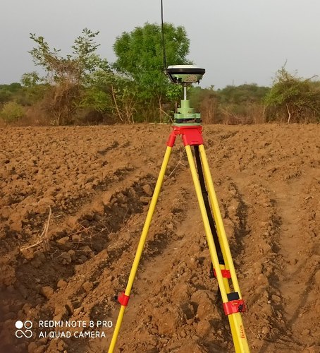
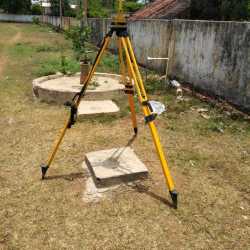
A DGPS surveyor specializes in conducting land and infrastructure surveys using Differential Global Positioning System (DGPS) technology. DGPS enhances the accuracy of standard GPS by correcting signal errors, delivering real-time positioning data with sub-meter to centimeter-level precision.DGPS surveying is ideal for topographic mapping, boundary demarcation, route alignment, pipeline and road projects, and infrastructure planning. By using a base station and one or more rover receivers, DGPS surveyors ensure that positional data is accurate and consistent across the entire survey area.At Lucknow Land Surveyors, our expert DGPS surveyors use advanced equipment such as Satlab systems to conduct surveys for:
- Highway and road alignment
- Irrigation and canal planning
- Railway and transmission line surveys
- Land parcel mapping
- Geospatial data collection for GIS projects
Survey Mapping – Accurate, Reliable & High-Precision Mapping Solutions
Survey mapping is the process of collecting, analyzing, and presenting geographical data to create detailed maps and layouts of land, infrastructure, and terrain features. It plays a critical role in urban planning, construction, land development, agriculture, mining, and infrastructure projects. Accurate survey mapping ensures informed decision-making, legal compliance, and efficient project execution.
At Lucknow Land Surveyors, we provide professional survey mapping services using advanced tools such as Total Stations, DGPS, LiDAR, UAV (Drone) Mapping, and GIS software. Our experienced surveyors deliver high-precision maps for a wide range of applications, including:
- Topographic surveys
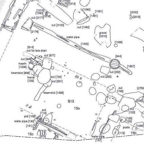
- Land boundary and cadastral mapping
- Contour and elevation mapping
- Utility and infrastructure mapping
- Route alignment for roads, railways, and pipelines
- Site layout and planning maps
Whether you are a government agency, construction company, real estate developer, or engineering consultant, our survey mapping solutions are designed to meet your specific project requirements with accuracy and reliability.
Highway Surveyor – Precision in Road Network Development
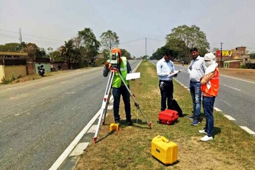
A highway surveyor plays a crucial role in the planning, designing, and construction of modern road networks. Highway surveying involves the precise measurement and mapping of land to determine the most suitable routes for highways, expressways, and road infrastructure projects. Using advanced instruments such as Total Stations, GPS/DGPS, Auto Levels, and drones, highway surveyors ensure accuracy in alignment, gradients, curves, and elevations—vital for smooth and safe road construction.
The survey process begins with reconnaissance and feasibility studies, where surveyors evaluate terrain, soil conditions, and existing obstacles. Detailed topographic and alignment surveys are then conducted to prepare contour maps, cross-sections, and longitudinal profiles. These surveys help engineers and planners design cost-effective and sustainable highways while minimizing environmental and social impacts.
Skilled highway surveyors also provide construction layout services, ensuring that designed plans are executed correctly on-site. They mark centerlines, levels, and boundaries required for excavation, embankments, pavement layers, bridges, culverts, and other road features. Their expertise supports seamless coordination between engineers, contractors, and government authorities.
Highway surveyors are also essential for road widening projects, bypass construction, hill road development, and maintenance surveys. By leveraging modern surveying technologies, they help reduce errors, save time, and enhance efficiency in highway development.
A Property Surveyor provides accurate land measurement, boundary marking, and legal verification services. They ensure clear property ownership, prevent disputes, and support construction, buying, or selling. Trusted for delivering precise property and land survey solutions.
A Quantity Surveyor specializes in cost estimation, project budgeting, and financial management for construction projects. They ensure accurate material take-offs, tendering, and cost control, helping developers, contractors, and clients deliver quality projects within budget and on time.
A Digital Land Surveyor uses advanced tools such as GPS, DGPS, Total Stations, and drones to deliver precise mapping, boundary marking, and topographic surveys. Digital land surveying ensures high accuracy, faster results, and reliable data for construction, property, and infrastructure projects.
A Land Plotting Surveyor provides accurate measurement and division of land into plots for residential, commercial, or industrial use. They ensure precise boundaries, layout planning, and legal compliance, supporting real estate, construction, and property development projects.
When it comes to accurate, reliable, and efficient land surveying in Lucknow, the Best Land Surveyor in Lucknow delivers unmatched service. With expertise in Total Station surveys, topographic mapping, boundary demarcation, layout planning, and digital mapping, they use advanced instruments such as GPS, DGPS, drones, LiDAR, and GIS systems to generate precise and dependable results.
A Top Land Surveyor delivers precise land measurement, boundary demarcation, and mapping services using advanced tools such as GPS, DGPS, Total Stations, and drones. Trusted by builders, developers, and property owners for accurate surveys, legal compliance, and seamless project execution.
Layout Designing Survey – Accurate Planning for Residential, Commercial & Industrial Projects
A Layout Designing Survey is an essential step in the planning and development of residential, commercial, and industrial projects. It involves the precise measurement, division, and mapping of land into plots or sections according to approved design plans and legal regulations. This survey ensures accurate demarcation of boundaries, road alignments, open spaces, utility areas, and amenities, creating a clear and reliable blueprint for property developers, real estate companies, and landowners.
Using advanced instruments such as Total Stations, GPS/DGPS, Auto Levels, and Drone Technology, layout designing surveyors provide accurate data for drafting layouts that comply with local authority guidelines such as LDA (Lucknow Development Authority) approvals, RERA norms, and municipal standards. Proper layout planning not only enhances the functionality and aesthetics of a project but also ensures that land utilization is efficient, legally compliant, and future-ready.
City Surveyor – Supporting Urban Growth with Accurate Land & Infrastructure Surveys
A City Surveyor plays a vital role in urban development and infrastructure planning. Their primary responsibility is to conduct accurate land surveys, prepare maps, and provide technical data essential for town planning, construction, and governance. In fast-growing cities, a city surveyor ensures that land usage, property records, and development projects are properly aligned with municipal and government regulations.
Using modern instruments such as Total Stations, GPS/DGPS, Auto Levels, GIS mapping, and drone technology, city surveyors deliver highly accurate measurements for roads, drainage systems, public utilities, and building layouts. They also handle property boundary demarcation, topographic mapping, and land record verification, helping prevent disputes and supporting transparent urban planning.
**A professional city surveyor is crucial in:**
Property Surveys: Identifying exact property lines and updating municipal records.
Infrastructure Projects: Supporting roads, metro systems, bridges, pipelines, and drainage works with precise survey data.
Town Planning & Layouts: Preparing legal and technical maps for residential, commercial, and industrial developments.
Government Approvals: Assisting with documentation and compliance for approvals from municipal corporations, development authorities, and urban bodies.
Marine Surveyor inspects ships, boats, and marine equipment to ensure safety, seaworthiness, and regulatory compliance. They assess vessel condition, cargo handling, and maintenance, providing detailed reports, certifications, and recommendations for repairs or improvements to owners, insurers, and maritime authorities.
Industrial Land Surveyor – Precision Surveys for Industrial Development
An Industrial Land Surveyor specializes in surveying land designated for factories, warehouses, manufacturing units, and large-scale industrial projects. Unlike standard property surveys, industrial land surveying demands a high level of precision to accommodate heavy infrastructure, machinery setups, transportation access, utility lines, and strict compliance with government regulations.
Using advanced technology such as **Total Station, GPS/DGPS, Drone Surveying, GIS Mapping, and AutoCAD Designing**, an industrial land surveyor provides accurate data on land boundaries, topography, elevation, and soil levels. This data is crucial for planning site layouts, designing internal roads, setting up drainage systems, and ensuring proper land utilization.
Key Services Offered by Industrial Land Surveyors:
- Boundary & Demarcation Surveys: Establishing accurate legal property lines to prevent disputes.
- Topographic & Contour Surveys: Mapping terrain details for effective site planning and infrastructure design.
- Layout Designing: Preparing CAD-based layouts for factory plots, utility zones, parking areas, and internal access roads.
- Pipeline & Utility Surveys: Marking the alignment of water, electricity, and gas pipelines.
- Compliance & Approvals: Supporting documentation for industrial authorities, SEZs, and government approvals.
Development Surveyor – Supporting Sustainable Urban & Rural Growth
A Development Surveyor plays a crucial role in shaping urban and rural development by providing accurate land measurement, mapping, and planning services for residential, commercial, and infrastructure projects. Their expertise ensures that every project complies with egal regulations, optimizes land utilization, and supports long-term sustainability**.
Using advanced tools such as Total Station, GPS/DGPS, Drone Surveys, GIS Mapping, and AutoCAD Designing, development surveyors deliver precise data required for land acquisition, plot division, layout planning, and construction alignment. This data forms the foundation for approvals from development authorities, municipalities, and government bodies, ensuring smooth project execution.
Key Responsibilities:
Land Assessment & Demarcation: Identifying exact property boundaries to prevent disputes.
Topographic & Contour Surveys:Mapping terrain details for accurate site planning and infrastructure design.
Layout Design & Planning: Preparing CAD-based layouts for housing colonies, townships, industrial parks, and commercial complexes.
Infrastructure Support:Conducting surveys for roads, drainage systems, pipelines, and utilities within projects.
Legal & Compliance Assistance: Facilitating approvals from local development authorities (e.g., LDA) and ensuring adherence to RERA norms.
Estimate Surveyor – Accurate Cost & Quantity Planning for Projects
An Estimate Surveyor plays a vital role in construction, infrastructure, and real estate projects by providing accurate cost estimation and quantity calculations. Their expertise ensures that developers, contractors, and property owners have a clear financial roadmap before starting any project. By analyzing drawings, measurements, material requirements, and labor costs, an estimate surveyor supports budgeting, tendering, and financial planning.
Using modern software tools such as AutoCAD, MS Excel, and estimation software, along with surveying instruments like Total Station and GPS, estimate surveyors combine technical data with financial insights to deliver precise project estimates. Their calculations cover material take-offs, earthwork volumes, structural quantities, and finishing works, ensuring no hidden cost surprises during construction.
Key Services of an Estimate Surveyor:
Cost Estimation: Preparing detailed estimates for residential, commercial, industrial, and infrastructure projects.
Quantity Take-off: Measuring and calculating materials such as cement, steel, concrete, and bricks required for execution.
Budget Planning: Providing accurate cost forecasts to help clients allocate resources effectively.
Tender Preparation: Assisting contractors with tender documentation and competitive pricing.
Project Monitoring: Ensuring the project stays within budget by tracking costs during construction.
Solar Panel Survey is the first and most important step before installing a solar energy system. It involves a detailed assessment of the site to determine its suitability for solar panels, ensuring maximum efficiency, safety, and return on investment. A professional solar panel surveyor evaluates roof conditions, shading, structural strength, and available space to design the best solar layout.Using advanced tools like GPS, Total Station, Drone Mapping, and Solar Analysis Software, surveyors provide accurate measurements and data on roof orientation, tilt angle, and sunlight exposure. This data helps in optimizing solar panel placement for maximum energy generation.
Key aspects of a Solar Panel Survey include:
- Site Assessment: Evaluating roof or ground space, structural safety, and load capacity.
- Shading Analysis: Checking nearby trees, buildings, or obstacles that may block sunlight.
- Solar Mapping & Layout Design: Planning the ideal position, direction, and tilt for panels.
- Electrical Feasibility: Assessing wiring routes, inverter placement, and connection to the grid.
- Cost & Efficiency Estimation: Providing accurate projections of power output and savings.
Cross Sectional Survey – Accurate Terrain Profiling for Infrastructure Projects
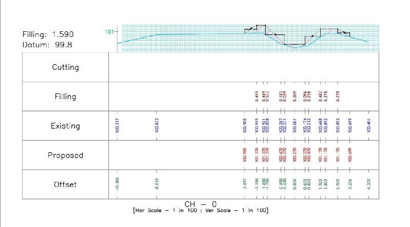
A Cross Sectional Survey is a specialized type of land and engineering survey used to measure and represent the shape, elevation, and profile of the ground at regular intervals along a specific alignment. This survey is essential for infrastructure projects such as roads, railways, canals, pipelines, bridges, and drainage systems, as it provides accurate data on terrain variations and ground levels.
Using advanced instruments such as Total Station, GPS/DGPS, Auto Level, and Drone Technology, surveyors collect detailed information at fixed intervals along the alignment. This data is then used to create cross-sectional drawings** that represent the vertical profile of the land in relation to the project design.
Key Applications of Cross Sectional Surveys:
- Road & Highway Construction: Determining cut and fill quantities for earthwork.
- Canal & Drainage Projects: Calculating water flow capacity and ensuring proper gradient.
- Pipeline Installation: Mapping terrain variations for accurate alignment.
- Railway Projects: Designing stable and safe track beds.
- Structural Foundations: Assessing ground conditions for bridges, culverts, and embankments.
Electric Line Survey – Accurate Planning for Power Transmission & Distribution
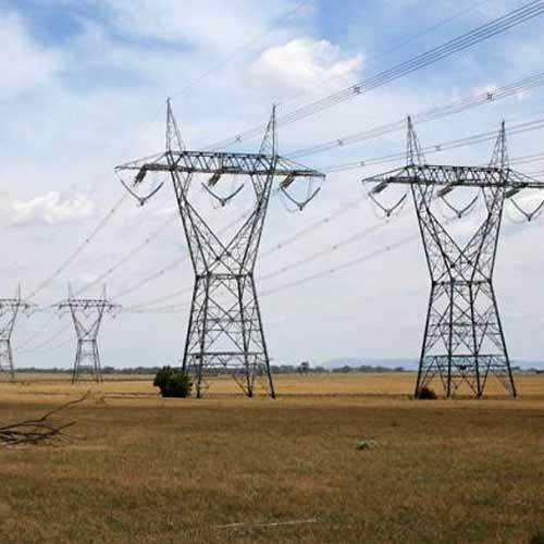
An Electric Line Survey is a specialized survey service carried out to design, plan, and implement overhead or underground electrical transmission and distribution lines. It plays a critical role in developing power infrastructure, ensuring accurate alignment, safety compliance, and cost-effective execution.
Using advanced surveying instruments such as Total Station, GPS/DGPS, Drone Mapping, and GIS technology, electric line surveyors provide precise data for engineers and utility companies.
The process involves route alignment, topographic mapping, and obstacle identification, helping determine the most feasible and economical path for electric lines. Surveys also ensure compliance with government regulations, safety standards, and environmental guidelines.
Key Applications of Electric Line Surveys:
Transmission Line Survey: Planning high-voltage transmission lines over long distances.
Distribution Line Survey: Designing low and medium-voltage lines for residential and industrial areas.
Underground Cable Survey: Mapping routes for safe cable installation with minimal disruption.
Tower & Pole Positioning: Identifying exact locations for towers, poles, and substations.
Right of Way (ROW) Surveys: Ensuring legal permissions and clearances for line installation.
Electric line surveyors work closely with power companies, government bodies, and contractors to deliver accurate survey data that supports reliable electricity supply and infrastructure growth. Their expertise ensures efficiency, reduces risks, and prevents costly rework.
Existing Surveyor – Accurate Documentation of Developed Sites
An Existing Surveyor specializes in conducting surveys of already developed or partially developed land, buildings, and infrastructure. Unlike preliminary land surveys, an existing survey focuses on documenting current site conditions, boundaries, and structures to provide accurate records for renovation, redevelopment, or compliance purposes. This type of survey is crucial for architects, engineers, property developers, and government authorities who require reliable data about the present state of a property.
Using modern instruments like Total Station, GPS/DGPS, Auto Levels, Drones, and GIS mapping tools, existing surveyors capture detailed measurements of land, roads, utilities, drainage systems, and built-up areas. The collcted data is then converted into CAD drawings, contour maps, or digital 3D models, which are used for planning extensions, upgrades, or legal verifications.
Key Applications of Existing Surveys:
Property Documentation: Verifying current boundaries and building dimensions.
Renovation & Redevelopment: Providing base maps for architects and engineers to plan modifications.
Infrastructure Upgrades: Surveying roads, pipelines, and electrical networks before expansion.
Legal & Compliance Needs: Preparing accurate reports for government approvals and dispute resolution.
As-Built Drawings: Recording completed construction for project handover and records.
An Existing Surveyor works closely with real estate developers, construction companies, and municipal bodiesto ensure that projects are based on updated site information. Their surveys help prevent costly errors, ensure legal compliance, and provide clarity for future planning**.
Water Body Surveyor – Accurate Surveying & Mapping of Water Resources
A Water Body Surveyor specializes in surveying and mapping natural and man-made water bodies such as rivers, lakes, ponds, reservoirs, wetlands, and canals. These surveys are essential for water resource management, irrigation projects, flood control, aquaculture, urban planning, and environmental conservation. By providing accurate data on size, depth, boundaries, and storage capacity, water body surveyors help governments, developers, and communities make informed decisions about water usage and sustainability.
Using advanced technologies like DGPS, Total Station, Drones, Bathymetric Equipment, and GIS Mapping, surveyors capture precise measurements of water spread area, depth profiles, and surrounding topography. This data is further processed into digital maps, 3D models, and CAD drawings for planning, analysis, and legal documentation.
Key Services of a Water Body Surveyor:
Boundary Demarcation: Identifying legal limits of water bodies to prevent encroachment.
Hydrographic & Bathymetric Surveys: Measuring water depths and silt levels.
Capacity Estimation: Calculating storage potential for drinking water, irrigation, or industrial use.
Environmental Monitoring: Assessing siltation, water quality, and ecological balance.
Restoration Planning: Providing technical inputs for desilting, embankment strengthening, and conservation projects.
| Usage | Precision Surveying Using Advanced Electronic Instruments |
Total Station Surveyor – Precision Surveying with Advanced Instruments
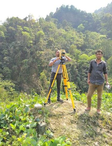
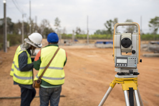
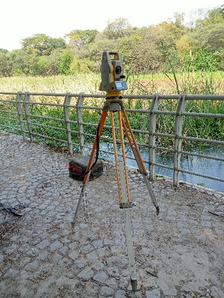
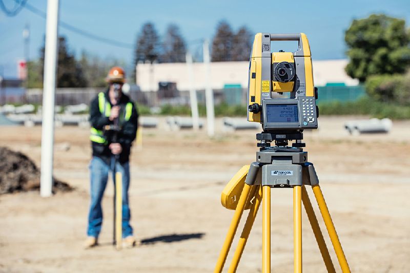
A Total Station Surveyor is a professional who uses advanced electronic surveying instruments known as Total Stations to measure angles, distances, and elevations with high accuracy. These surveyors play a vital role in land development, construction, infrastructure projects, and property documentation by delivering precise survey data and digital maps.
The Total Station integrates electronic distance measurement (EDM), angle measurement, and data recording, allowing surveyors to collect field data quickly and accurately. A Total Station Surveyor can generate detailed topographic maps, 3D terrain models, and CAD-based layouts, which are crucial for engineering design and project execution.
Key Applications of Total Station Surveys:
Land & Property Surveys: Accurate boundary marking and legal documentation.
Construction Layouts: Aligning foundations, columns, roads, and utilities.
Topographic & Contour Mapping: Recording terrain levels for planning.
Infrastructure Projects: Supporting roads, bridges, railways, pipelines, and drainage systems.
Volume Calculations: Estimating earthwork for excavation and embankments.
Hiring a professional Total Station Surveyor ensures speed, accuracy, and efficiency compared to traditional survey methods. Their data eliminates manual errors, saves time, and provides precise inputs for architects, engineers, and developers. Total Station surveys are also widely accepted for government approvals, legal disputes, and land registration due to their reliability.
Road Surveyor – Precision Surveys for Road & Highway Projects
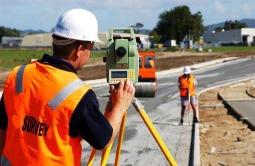
A Road Surveyor plays a key role in the planning, design, and construction of roads, highways, and expressways. Their primary responsibility is to conduct detailed surveys that provide accurate data on land levels, alignment, gradients, and terrain conditions, which is crucial for engineers and planners to design cost-effective, safe, and durable road networks.
Using advanced instruments such as Total Stations, GPS/DGPS, Auto Levels, Drones, and GIS Mapping, road surveyors collect precise measurements of the land. These surveys include topographic mapping, contour studies, cross-section, and longitudinal profiles, vital for road alignment and construction planning.
Key Tasks of a Road Surveyor:
- Route Alignment Surveys: Identifying the most suitable path for roads or highways.
- Topographic & Contour Mapping: Recording terrain elevations for accurate design.
- Earthwork & Volume Calculations: Estimating cut and fill quantities for construction.
- Construction Layout: Marking center lines, curves, slopes, and levels on-site.
- Quality & Compliance Checks: Ensuring road projects follow engineering and government standards.
Road surveyors work closely with civil engineers, contractors, and government authorities to deliver reliable data that supports both new road construction and maintenance projects, reducing errors, minimizing costs, and ensuring long-lasting infrastructure.


