

City Surveyor – Supporting Urban Growth with Accurate Land & Infrastructure Surveys
A City Surveyor plays a vital role in urban development and infrastructure planning. Their primary responsibility is to conduct accurate land surveys, prepare maps, and provide technical data essential for town planning, construction, and governance. In fast-growing cities, a city surveyor ensures that land usage, property records, and development projects are properly aligned with municipal and government regulations.
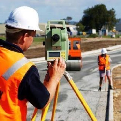
Using modern instruments such as Total Stations, GPS/DGPS, Auto Levels, GIS mapping, and drone technology, city surveyors deliver highly accurate measurements for roads, drainage systems, public utilities, and building layouts. They also handle property boundary demarcation, topographic mapping, and land record verification, helping prevent disputes and supporting transparent urban planning.
**A professional city surveyor is crucial in:**
Property Surveys: Identifying exact property lines and updating municipal records.
Infrastructure Projects: Supporting roads, metro systems, bridges, pipelines, and drainage works with precise survey data.
Town Planning & Layouts: Preparing legal and technical maps for residential, commercial, and industrial developments.
Government Approvals: Assisting with documentation and compliance for approvals from municipal corporations, development authorities, and urban bodies.


