

DGPS Surveyor – Precision Land Surveying with Sub-Meter Accuracy
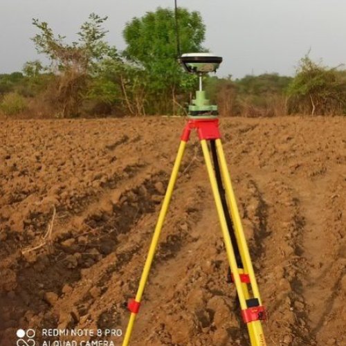
A DGPS surveyor specializes in conducting land and infrastructure surveys using Differential Global Positioning System (DGPS) technology. DGPS enhances the accuracy of standard GPS by correcting signal errors, delivering real-time positioning data with sub-meter to centimeter-level precision.DGPS surveying is ideal for topographic mapping, boundary demarcation, route alignment, pipeline and road projects, and infrastructure planning. By using a base station and one or more rover receivers, DGPS surveyors ensure that positional data is accurate and consistent across the entire survey area.At Lucknow Land Surveyors, our expert DGPS surveyors use advanced equipment such as Satlab systems to conduct surveys for:
- Highway and road alignment
- Irrigation and canal planning
- Railway and transmission line surveys
- Land parcel mapping
- Geospatial data collection for GIS projects


