

5,000.00 - 15,000.00 / Day
Get Best Price
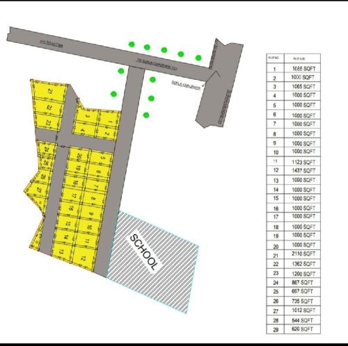
Layout Plot Marking – Accurate Land Division for Development Projects
Layout Plot Marking is a vital stage in land development, construction, and real estate projects. It involves the accurate division and marking of land into plots based on approved designs and legal documents. By using precise survey methods, layout plot marking ensures that each plot is properly aligned with roads, open spaces, utilities, and boundaries as per municipal or development authority guidelines.
Professional surveyors use Total Station, GPS/DGPS, Auto Level, and CAD software to mark plots with high accuracy. The process begins with detailed land measurement, followed by demarcation of roads, plot corners, and public spaces. Each plot is marked with permanent reference points or pegs, which serve as the foundation for future construction.
Key Benefits and Applications of Layout Plot Marking:
- Residential & Commercial Projects: Dividing large land parcels into legally approved plots.
- Township & Housing Colonies:Ensuring roads, amenities, and open spaces are correctly aligned.
- Industrial Layouts: Marking factory plots, internal roads, and utility zones.
- Compliance with Authorities: Preparing layouts that meet LDA, RERA, or municipal standards.
- Legal & Transparent Transactions: Providing clear plot boundaries for buyers and developers.
Accurate layout plot marking prevents boundary disputes, encroachments, and planning errors, making it a critical step in real estate development. It also helps developers showcase properly designed and approved layouts to potential buyers, increasing trust and property value.
Looking for "Layout Plot Marking" ?
Day


